
DENVER(CBS4)- Our last storm system crossing the state was powerful enough to produce intense wind gusts of 50-80 mph. These winds fueled super strong snow squalls and dust storms across the state. The travel troubles started early and continued in many parts of Colorado.
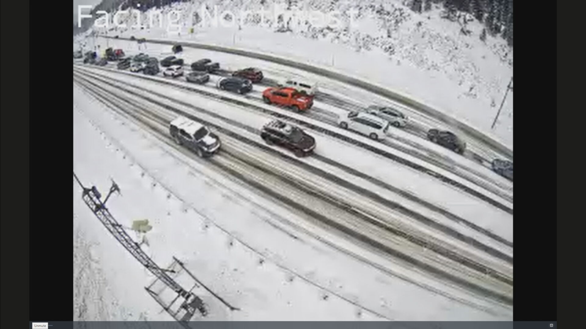
A view of winter driving conditions on I-70 near the Eisenhower Johnson Tunnels on 12/26. (credit: Colorado Department of Transportation)
Security closures lifted on I-70 in Colorado’s high country
Snow squall warnings were issued from southern Wyoming to northern Colorado. Here is such a storm in the Steamboat Springs area.
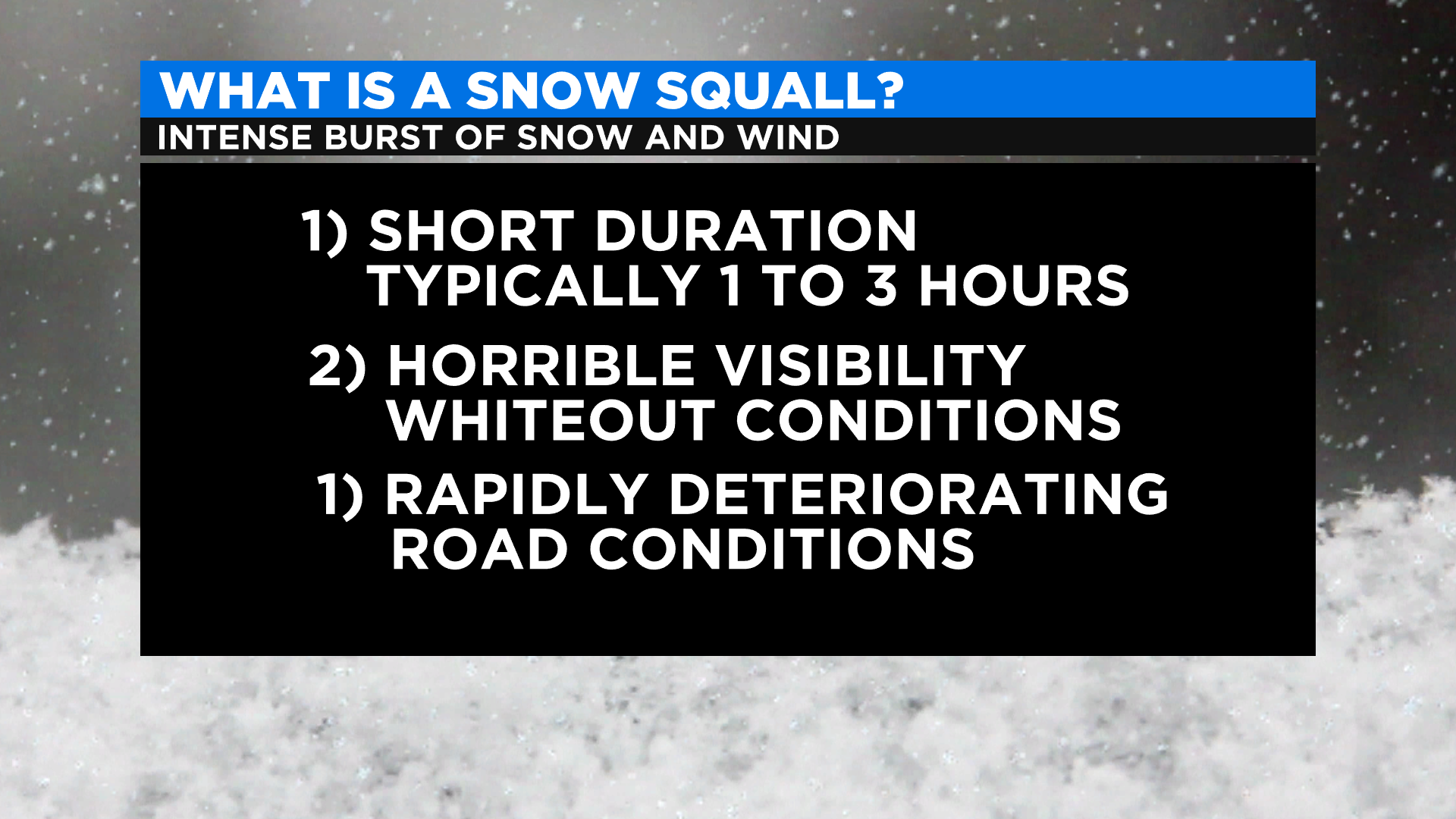
A snow squall is an intense blast of wind and snow.
Credit: CBS4
Here’s a look at one of the snow squalls in Meeker!
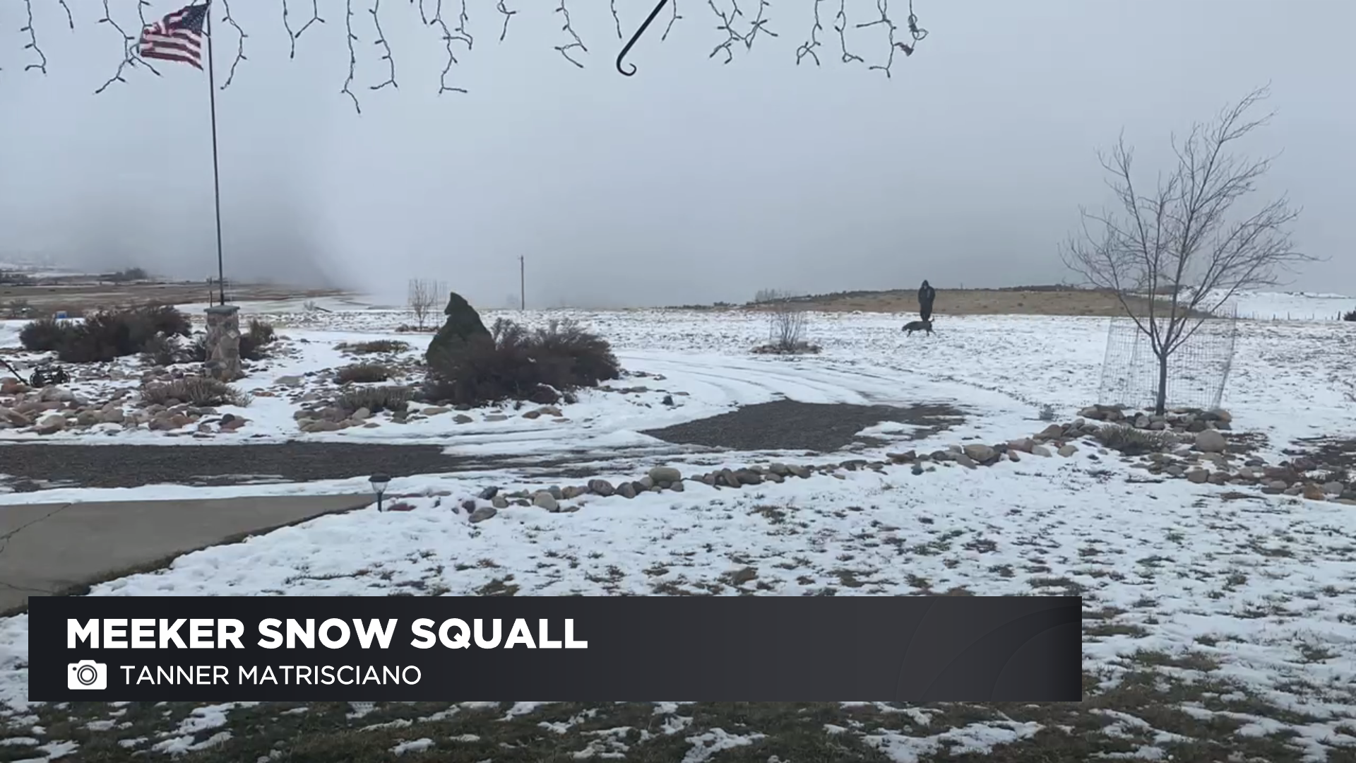
Credit: YouReporter Tanner Matrisciano
On the eastern plains, high winds of at least 60 mph created dust storms and terrible visibility along eastern highways Sunday afternoon.
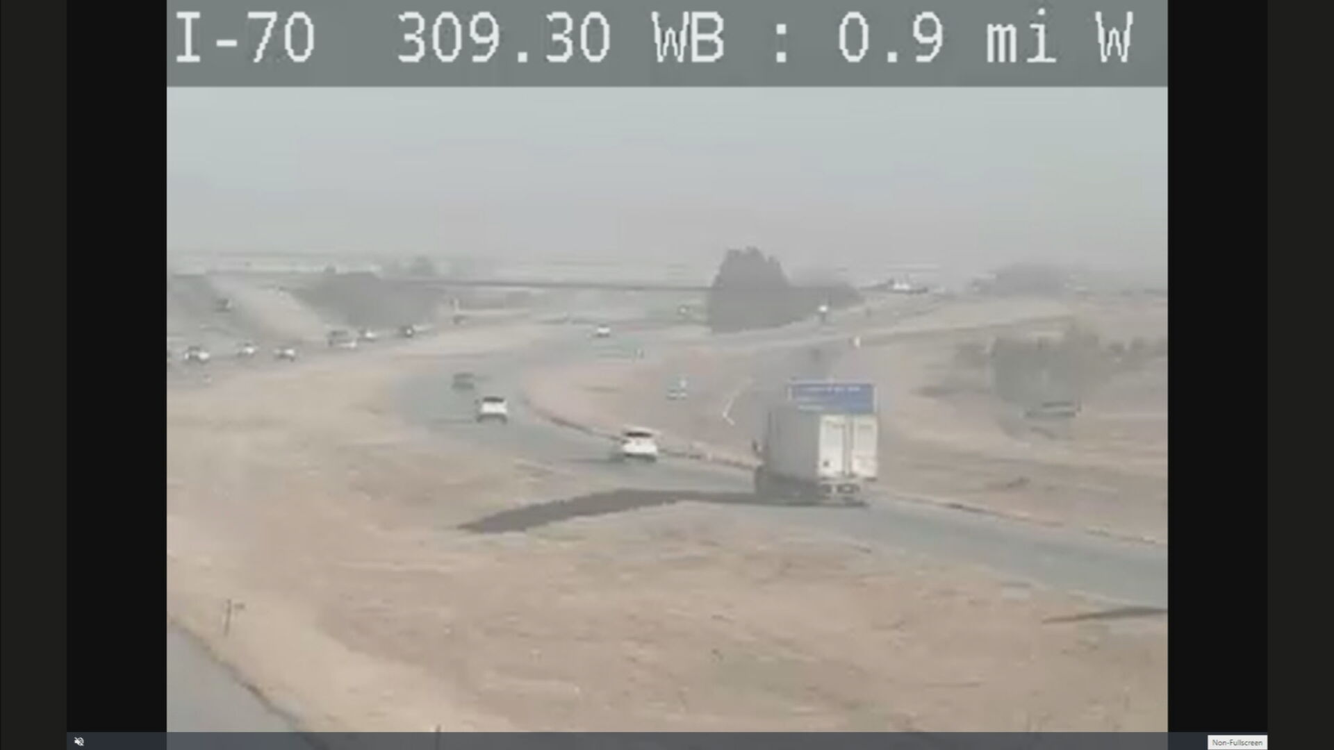
(credit: Colorado Department of Transportation)
Both directions of I-70 near Byers closed for accident
More light snow and wind are expected in the mountains on Monday but should not be as intense as the squalls on Sunday.
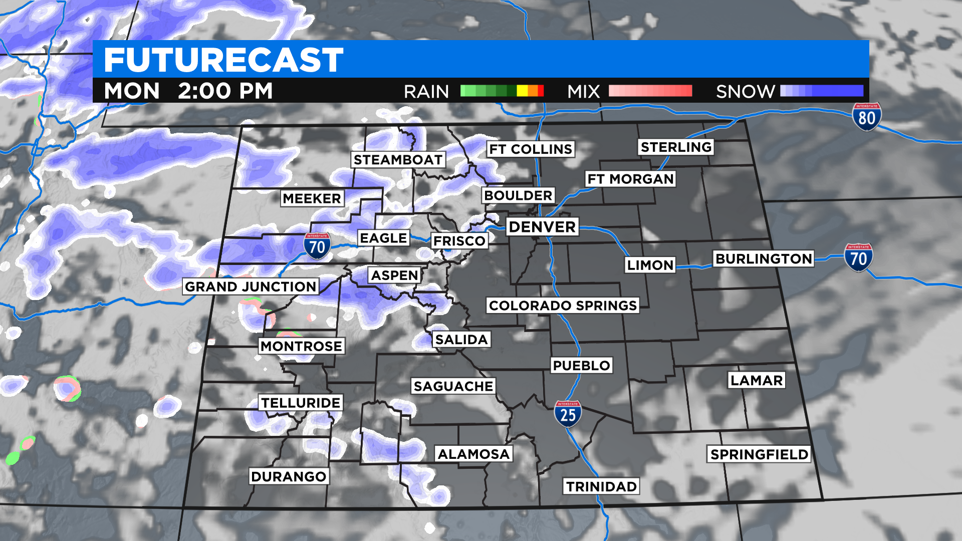
Credit: CBS4
Snowfall amounts from Sunday evening through Monday evening are expected to add about another 2 to 5 inches with gusty winds.
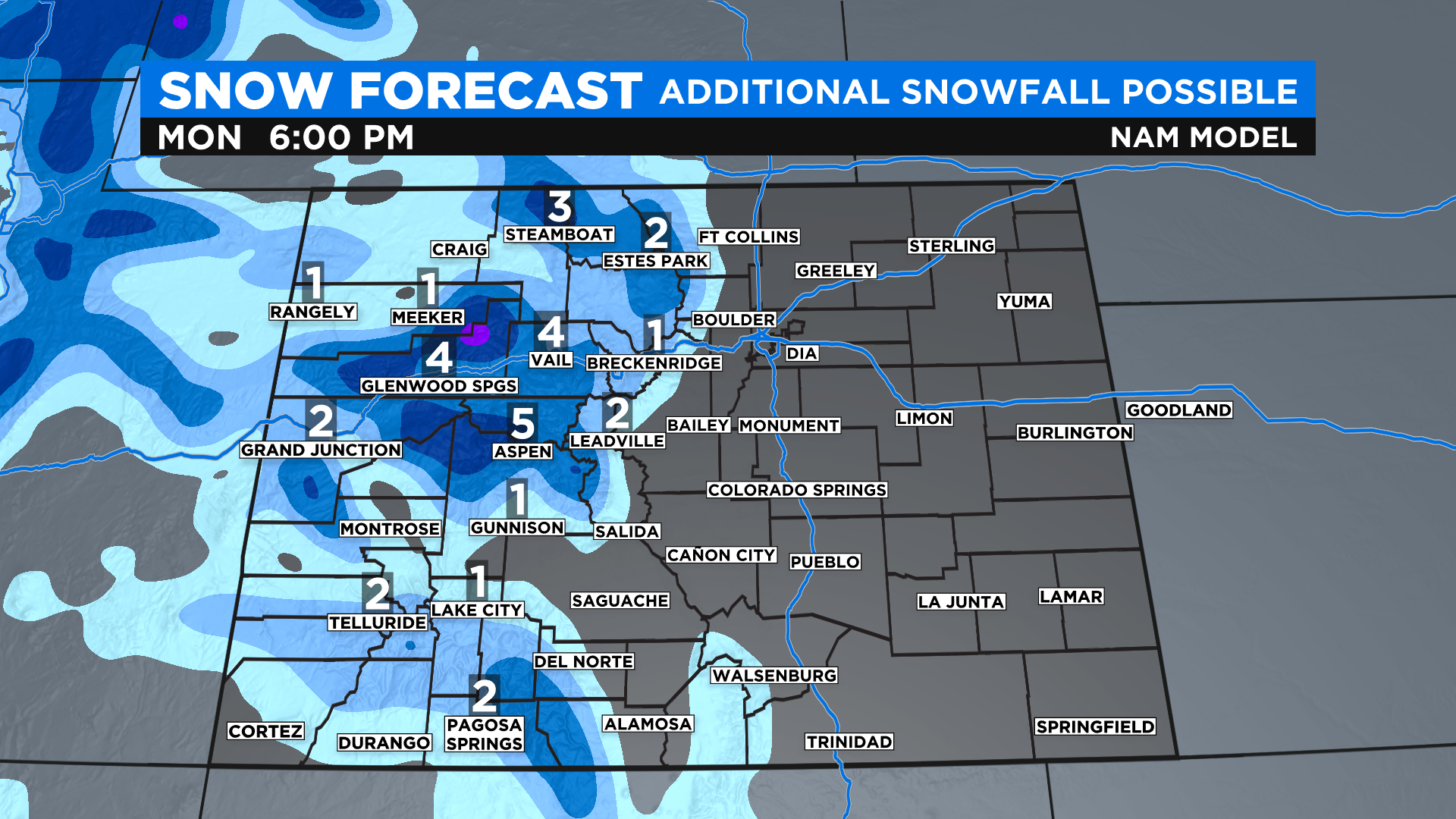
Credit: CBS4
Another storm system is expected to produce more mountain snow on Tuesday, along with the possibility of a few flakes overnight in the Denver metro area Monday evening.
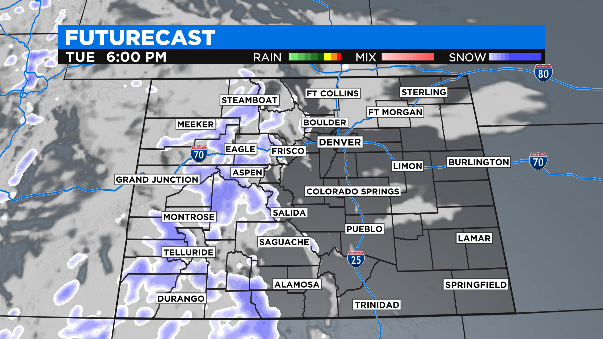
Credit: CBS4
Snowfall amounts can range from 3 to 6 inches for Tuesday in the mountains.
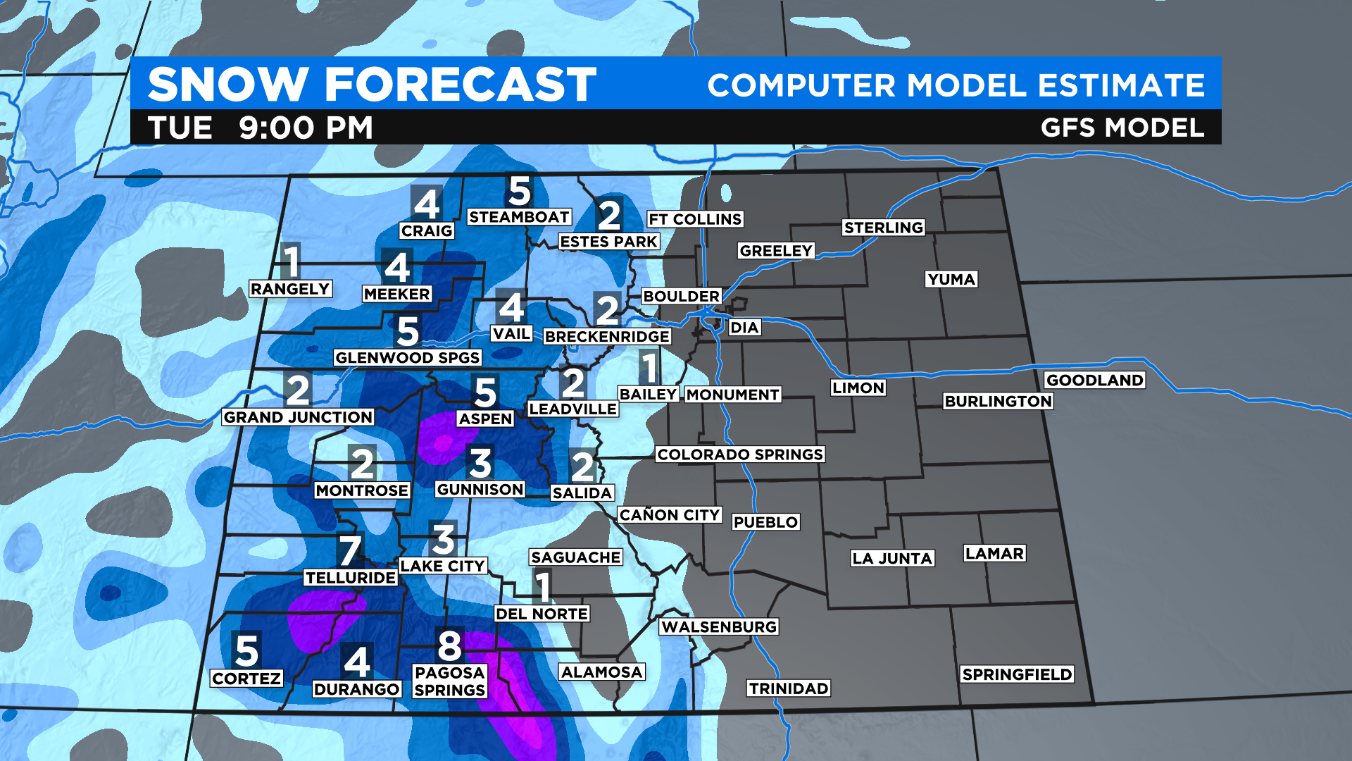
Credit: CBS4